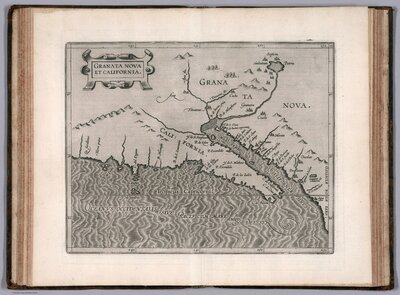
California as an Island
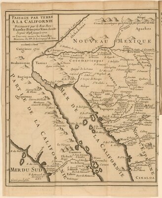
Depictions of California as part of North America begin early in the history of cartography. In 1562, the Spanish cartographer Diego Gutiérrez depicted California attached to the mainland on his seminal map of the Americas, and was later copied by other mapmakers like Abraham Ortelius and Gerardus Mercator. Sixty years later, the myth of California as an island began to appear in maps and continued into the early eighteenth century. In the late 1690s, Fr. Eusebio Francisco Kino, a Jesuit priest, traveled extensively in what is now California, Arizona, and northern Mexico; during his trek, he concluded that California was in fact a peninsula, and published a map demonstrating this in 1705.
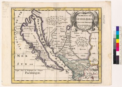
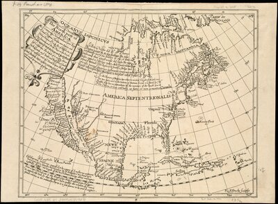
Audience de Guadalajara, Nouveau Mexique, Californie, &c.
This hand-colored map of the Audiencia or High Court of Guadalajara is one of the first maps to focus on California as an island, this one showing a variation of the northern coastline with two large bays. On the mainland, it shows the names of established places—such as New Mexico and Sinaloa—with the mythical cities of Quivira and Cibola.
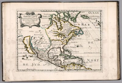
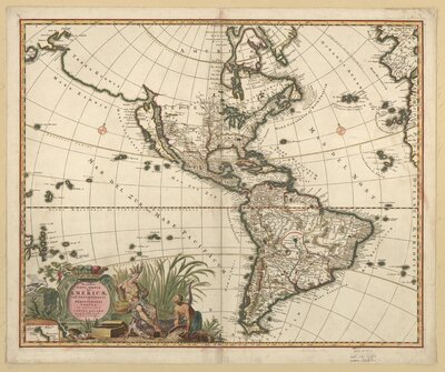
Recentissima novi orbis, sive Americae septentrionalis et meridionalis tabula
Produced in Amsterdam toward the end of the seventeenth century, this map of the Americas illustrates how Europeans staked their claim to much of the New World. Drawing heavily on the work of French cartographer Nicolas Sanson, the map includes a number of errors and misprojections, including the depiction of a landmass known as Terra Esonis, connecting the Straits of Anian to Japan, California as an island, and the confluence of the Colorado River and the Río Grande at a point near Santa Fe.