Search Constraints
Search Results
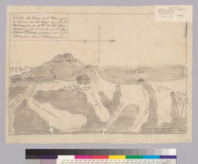
- Description:
- Created by the United States District Court for the Northern District of California. Land case. 338. Part of: Maps of private land grant cases of California.
Scale not given.
- Attribution:
- UC Berkeley, Bancroft Library
- Date:
- 184-?
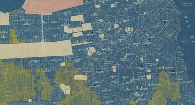
- Description:
- The creator is Michael Maurice O'Shaughnessy and it is published by Britton & Rey from San Francisco. Original annotated to show schools.
- Attribution:
- San Francisco, Britton & Rey, 1913.
- Date:
- 1913
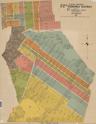
- Description:
- Set contains sheets for Assembly Districts 21-33.
Shows streets, precincts and house numbering system.
- Attribution:
- UC Berkeley Library
- Date:
- 1916
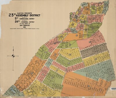
- Description:
- Set contains sheets for Assembly Districts 21-33.
Shows streets, precincts and house numbering system.
- Attribution:
- UC Berkeley Library
- Date:
- 1916
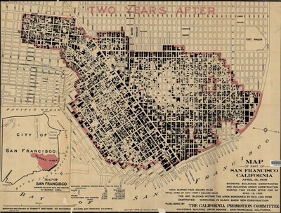
- Description:
- Created by Punnett Brothers and published by San Francisco California Promotion Committee. Includes statistical information and "Map of San Francisco showing relative size and position of burned area."
Shows burned area of 4 square miles.
Oriented with north toward the lower right.
- Attribution:
- UC Berkeley Library
- Date:
- 1908
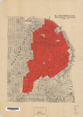
- Description:
- Created by R.J. Waters & Company and published by San Francisco, R.J. Waters & Co. Map covers only the northeastern portion of the city.
Burned area shown in red.
- Attribution:
- UC Berkeley Library
- Date:
- 1906