North Bay
The North Bay consists of four counties: Marin, Napa, Sonoma, and Solanos which are all located north of San Francisco. The largest city in the North Bay is Santa Rosa with a population of 177,586. The maps below show different historical views of the North Bay including maps on land development, land cases, military, nautical, and hiking.
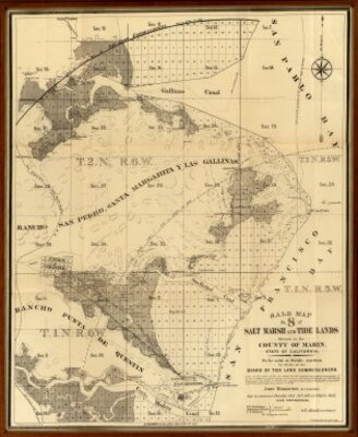
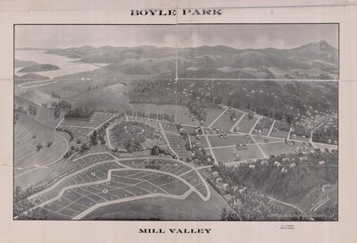
Land Development
There are different historic land development maps that show how the North Bay developed from open land to a suburban landscape. The maps below show a land development map that highlights the salt marshes and tide lands in Marin County and the other map focuses solely on one future real estate project for the City of Mill Valley.
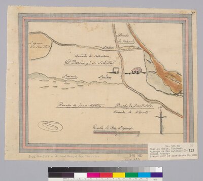
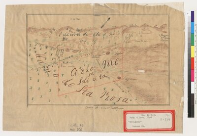
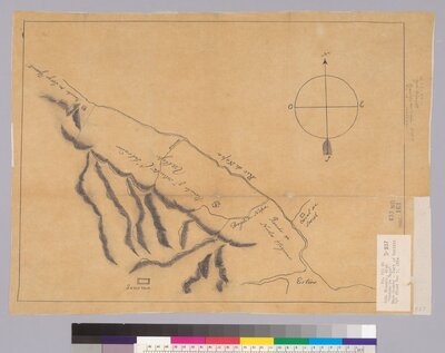
Land Cases
The U.S. Congress passed an act in 1851 that required holders of Spanish and Mexican land grants to present their title for confirmation from the Board of California Land Commissioners. The below land case maps are in Marin, Napa, and Sonoma County.
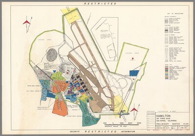
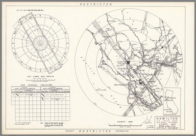
Military
There are different army constructions in the North Bay and the maps below show one such structure which in the present day is located in Novato, CA. The Hamilton Army Airfield was built in 1935 in San Rafael, CA and had a significant role during WWII. The two maps show the air base focusing on different aspects.
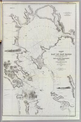
Nautical Chart
Nautical charts are produced for marine navigation. They contain information on all navigational aids, such as buoys and beacons, lighthouses, radio and radar stations, shipping channels, and restricted areas. Water depths are recorded as soundings--in meters, feet or fathoms and physical features such as shorelines, shallows, reefs, submerged rocks, shipwrecks, kelp beds, and ocean bottom sediments, are shown in detail.
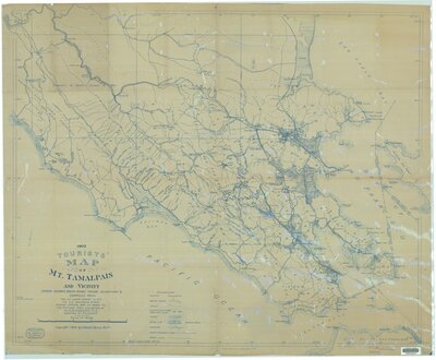
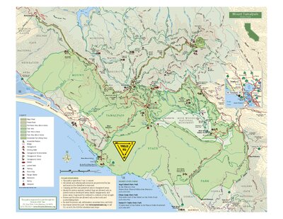
Trails
The North Bay is known for having wonderful hiking spots. Some of the best trails in the North Bay are located on Mount Tamalpais. The below maps show trails on the mountain in 1902 and 2016. Compare the two maps and see if you can find the same or new trails in the 2016 map.
Sources