Peninsula
The main county of the peninsula is San Mateo and its location is right under the city of San Francisco. Travel through time through the following maps.
Real Estate Maps
The below map was published by M.J. Conway and shows the subdivisions and land ownership in a portion of San Mateo, Burlingame, and Hillsborough.
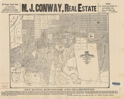
Map of the city of San Mateo, showing the latest additions and subdivisions
1912
Bird's Eye View
Bird's eye view maps show an elevated view and give a perspective that would be similar to a bird. The map below is a bird's eye view drawing of San Mateo County.
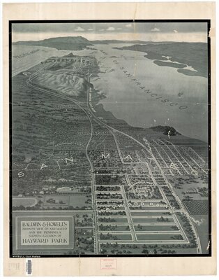
Baldwin & Howell's birdseye view of San Mateo and the peninsula showing location of Hayward Park
1907
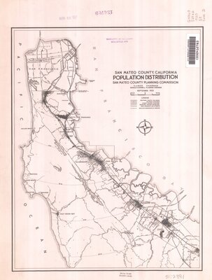
Population Density
Population density shows the number of people in an area. The map below shows the population density for San Mateo County in 1920. The population density map today would look much different than the 1920 map below.
Sources