East Bay
The East Bay includes the cities along the eastern shore of the San Francisco Bay and San Pablo Bay and it encompasses the two counties of Alameda and Contra Costa. University of California, Berkeley is located in the East Bay. The maps in this section document the development of the UC Berkeley campus, as well as the larger East Bay.
UC Berkeley Campus
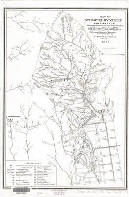
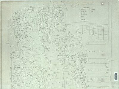
The 1875 map below shows the path of Strawberry Creek through Strawberry Canyon and down through the UC Berkeley campus (left). Can you locate the creek in the map on the right?
City of Berkeley
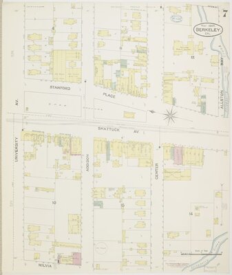
The city of Berkeley grew from about 5,000 people in 1890 to over 40,000 in 1910, the time period of the maps below. Sanborn maps were originally used by fire insurance companies to determine the potential risk of a particular building. Now they serve as a useful resource to understand how cities have grown and changed.
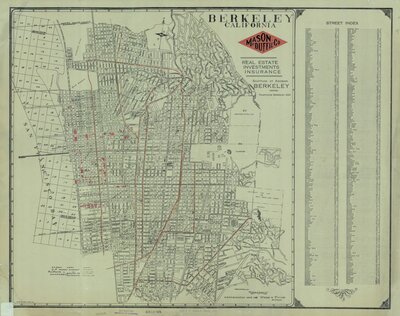
Note the path of Strawberry Creek through downtown Berkeley in 1894 (left). Then compare that map to the 1909 map of Berkeley by real estate developers, Mason-McDuffie, which shows how much the city as grown (right). Where was the Western edge of Berkeley in 1909?
The rest of the 1894 series of Berkeley Sanborn maps can be found on the Library of Congress website here: https://www.loc.gov/resource/g4364bm.g4364bm_g004191894/?st=gallery
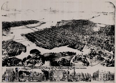
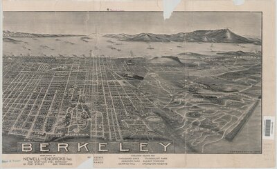
Birds Eye View
Birds Eye View maps gives you a perspective from above. Can you find Lake Merritt in the 1882 view of Oakland? Where does the Berkeley pier point in this 1909 view?
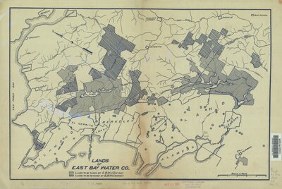
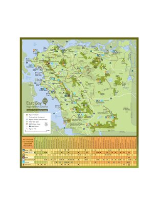
East Bay Water/Parks
Access to and storage of water locally is tied to the later development of East Bay parks. Look at the lands owned by the East Bay Water Company and what became the East Bay Municipal Utility District in 1920 (left). Compare that representation to the current map of the East Bay Regional Parks (right).
Sources