Search Constraints
Search Results
- Description:
- Created by Chester Smith Lyman and James D. Hutton.
Includes County Surveyor's certification dated Jan. 21st, 1860.
Negative photocopy of manuscript map in the California State Library.
Oriented with north toward the upper left.
Shows drainage, lot numbers, land ownership, etc.
- Attribution:
- UC Berkeley Library
- Date:
- 1847
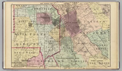
- Description:
- Published by Thompson & West from San Francisco. Shows townships, land grants, owners of large parcels with acreage, roads, schools, mines, etc. The full scanned atlas can be viewed at the David Rumsey collection site.
- Attribution:
- David Rumsey Historical Map Collection
- Date:
- 1876