Search Constraints
Search Results
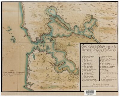
- Description:
- Created by Juan Manual de Ayala and José de Ca~nizares. "Nota el Presidio indicado numo. 1 y la Mision numo. 2 se han establecido por el Mes de Octubre del presente a~no de 1776."
Oriented with north toward upper right.
Shows forested areas, Mission Dolores and San Francisco Presidio.
Relief shown pictorially; soundings in brazos (or fathoms; 1 = ca. 1.67 meters).
Pen-and-ink and watercolor.
- Attribution:
- UC Berkeley Library
- Date:
- 1776
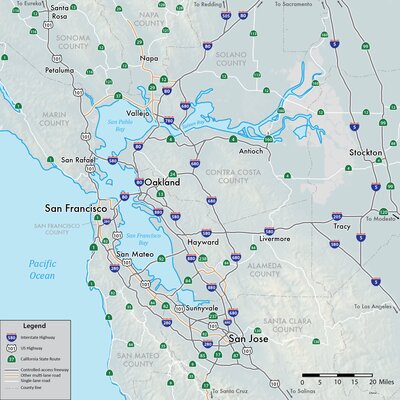
- Description:
- Author is Shannon1. Map showing freeways and other major roads in the San Francisco Bay Area, California, USA. Shaded relief from US Geological Survey.
- Attribution:
- Wikimedia Commons (https://commons.wikimedia.org/wiki/File:SFBay_Highways-01.png)
- Date:
- 2016
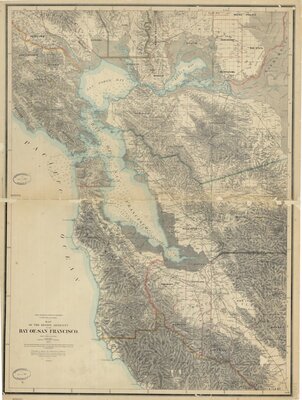
- Description:
- Created by Geological Survey of California in New York. In 2 sheets. Scale 1:126,720.
- Attribution:
- UC Berkeley Library
- Date:
- 1873